Location
Directions to the educational forest center
Directions to the educational forest center
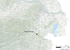
The educational forest is located on the Lower Austrian slopes of the Rosalia Mountains in the area of the municipalities of Ofenbach, Schleinz, Walpersbach and Hochwolkersdorf in the district of Wiener Neustadt. It covers an area of approx. 950 ha.
The address of the educational forest center is
Heuberg 82
7212 Forchtenstein
You can plan the route to the educational forest center via Google Maps
1. Topology
1. Topology
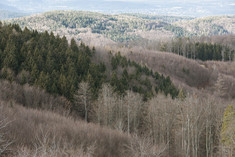
The area is formed by 4 main ditches (Mühlstein-, Kohl-, Grasriegel- and Trenkgraben) and numerous, mostly deeply incised side ditches, on the other hand by gently curved ridges.
The lowest point is at 320 m, the highest at 725 m above sea level. Blocky bedrock outcrops in some places.
Proportion of area covered by the altitude levels:
| Altitude | % | ha |
|---|---|---|
| 300-450 m | 16,3 | 146,6 |
| 450-550 m | 39,4 | 355,2 |
| 550-650 m | 37,8 | 340,5 |
| 650-750 m | 6,5 | 59,0 |
| 100,0 | 901,3 |
Proportion of the slope gradients:
| Slope gradient | % | ha |
|---|---|---|
| 0-10 % | 4 | 38,8 |
| 11-20 % | 11 | 101,0 |
| 21-30 % | 30 | 267,0 |
| 31-40 % | 29 | 259,3 |
| 41-50 % | 17 | 149,5 |
| > 51 % | 9 | 82,6 |
| 100,0 | 898,2 |
2. Geology
As in the entire area, crystalline rocks also predominate in the educational forest. In terms of area, potassium feldspar-bearing coarse-grained gneisses with very different structures predominate.
In the area of coarse-grained gneiss, one can often observe sharper landscape forms, even some small rock towers and coarse boulders.
Particularly in the southern part of the educational forest, small areas of platy, mostly strikingly light-colored sericite slate deposits can often be found. Dark, partly chlorite-bearing phyllites also occur to a lesser extent, mainly in the north-west of the area. There, the landscape forms are gentler and in places characterized by old landslide and slope flow phenomena. In the northern part of the educational forest, there is a thrust clod of dolomite and dolomite breccia, which is assigned to the Semmering Mesozoic.
In a very small part of the educational forest in the west, sandy tertiary sediments and coastal boulders can be found. Recent soil formation in the area of the educational forest often takes place on the remains of old Tertiary and interglacial soil and weathering layers. However, they have undergone significant changes during the ice ages due to the processes taking place in the periglacial area. Soil flow eroded the ground cover of the higher and steeper parts of the landscape in many cases down to the weathering base of rock debris and grit.
The lighter and more permeable soils on coarse-grained gneiss were naturally the most affected. In the depositional area, flowing soils of great thickness characterized by the directional deposition of little weathered rock debris are frequently found. Old, mostly thick, dark brown to reddish-brown colored, strongly cohesive soil layers have been preserved relatively intact, mainly in the phyllite area. In the dolomite area, brown clay residues or dolomite rubble form the basic material for soil formation.
In the western part, today's soils developed in places on tertiary loose sediments, in the valleys on predominantly sandy alluvions.
3. Soils
3. Soils
Different types of soil can be found in the area of the educational forest:
- Soils on siliceous material
- Groundwater-influenced soils
Gleye and wet gleye are found at the bottom of the valleys and in the area of hillside springs. The humus type is predominantly mull. Alluvial soils with rapidly changing layer sequences of variously sorted material characterize the floodplain area of the streams. - Brown earths and semi-podzols
Soils in this group make up the majority of the area in the training forest. Due to the substrate, the soils in this group usually only have a low iron content. This means that the typical iron-related horizon colorations are usually only moderately pronounced and are therefore often relatively difficult to identify.Due to the relatively base-poor parent material, brown earths are only found in typical form in a few places. They are bound to young rock weathering layers with a relatively high base replenishment capacity and therefore tend to occur at higher altitudes on fine to medium-grained, dark feldspar-rich coarse-grained gneiss, where the old leached soil covers have been largely eroded. The type of oligotrophic mull brown earth, which was certainly more common under deciduous forest, has now given way to acidic modern brown earth or semipodsol. - Semipodsols
Semipodsols are frequently found on coarse-grained gneiss weathering debris and skeleton-rich, seepage-permeable flowing soils as well as on skeleton-rich phyllite weathering debris. Due to the aforementioned lack of iron, the B horizons are usually only slightly intensely colored. Where the soils are still relatively close to the brown earths, the eluvial horizons are only weakly pronounced and often covered by the humus color. More typical semipodzols, however, show clear eluvial horizons. The humus formation consists of mould and raw humus, whereby the latter predominates. The thickness of the overlying humus rarely exceeds 5 cm. - Pseudogleye
Pseudogleye can be found relatively frequently in the training forest wherever less permeable material was the basis for soil formation. On the one hand, this is the case in the area of sericite shale deposits, whose fine-plate, silty weathered material tends to form dense layers, and on the other hand, wherever cohesive brown loam material from old soil covers in flowing soils gives rise to waterlogged horizons. Here too, the relative lack of iron in the parent material is expressed in a weak expression of gley staining and concretion formation.
The predominant type of humus is moder to hydromorphic moder, but duff and raw humus pseudogleye also occur. - Soils strongly influenced by brown clay
Soils strongly influenced by brown loam are found mainly in the area of the deposits of dark phyllites or in the deposition area of the weathering blankets that originally formed on them and then flowed away. Over thick layers of the mostly dark brown to reddish-brown colored, plastic brown loam material, which hardens extremely when it dries out, today's soil formation has only covered thin layers. The recent dynamics to which these soils are subject are podzolization on the one hand and pseudo-vergleyization on the other. The formation of humus is mostly mould and raw humus, rarely mull humus. - Soils on carbonate rock
Shallow rendzines are found on dolomite debris in exposed areas, and on less erosion-prone areas, averagely thin carbonate brown loams. - Soils on tertiary sediments
- In the western part of the training forest, deep, fertile mull brown soils are found on tertiary sands, occasionally with a slight tendency towards parabrown soils and pseudogley.
4. Forest
4. Forest
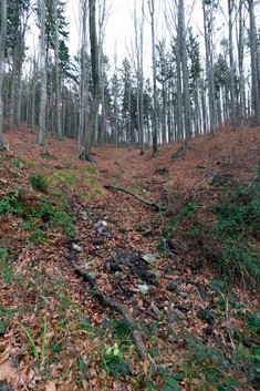
The natural forest communities resulting from the soil and climatic conditions are mainly beech forest communities (Luzulo-Fagetum and Asperulo-Fagetum). At higher altitudes and on the cooler northern slopes with deeper soil types, spruce-fir-beech forest communities (Abieti-Fagetum) can already be found. Sycamore maple-ash forests (Aceri-Fraxinetum) can be found on the ditch slopes, while ash-black alder stream-side forests (Pruno-Fraxinetum) predominate on the developed valley floors. In small areas, carbonate beech forest (Seslerio-Fagetum) occurs on carbonate bedrock (dolomite).
The following table provides an overview of the main tree species in the training forest:
(EKL=average total increment up to age 100 in fm/ha)
| Tree Species | Area (ha) | % | Stock (fm) | % | EKL |
|---|---|---|---|---|---|
| Sprouce (Picea abies) | 372,6 | 41,3 | 139.740 | 46,1 | 8,6 |
| Fir (Abies alba) | 20,4 | 2,3 | 6.666 | 2,2 | 9,6 |
| Douglas fir (Pseudotsuga menziesi) | 1,3 | 0,1 | 120 | 0,0 | - |
| Larch (Larix decidua) | 42,1 | 4,7 | 9.833 | 3,2 | 5,3 |
| Pine (Pinus silvestris) | 89,9 | 10,0 | 23.337 | 7,7 | 7,1 |
| Black pine (Pinus nigra) | 0,3 | 0,0 | 117 | 0,0 | 5,7 |
| Strobe (Pinus strobus) | 1,7 | 0,2 | 152 | 0,1 | - |
| Conifers in total | 528,3 | 58,6 | 179.965 | 59,3 | - |
| Beech (Fagus silvatica) | 326,1 | 36,2 | 115.939 | 38,2 | 7,0 |
| Oak (Quercus petraea) | 16,8 | 1,9 | 2.472 | 0,8 | 5,1 |
| Hornbeam (Carpinus betulus) | 6,9 | 0,8 | 1.151 | 0,4 | 4,5 |
| Other hardwood deciduous trees | 11,5 | 1,3 | 2.119 | 0,7 | 5,4 |
| Other softwood deciduous trees | 9,2 | 1,0 | 1.576 | 0,6 | 5,7 |
| Total deciduous trees | 370,5 | 41,1 | 123.257 | 40,7 | - |
| Clearing | 2,5 | 0,3 | 0 | 0,0 | - |
| Total | 901,3 | 100,0 | 303.222 | 100,0 | 7,6 |
These tree species are found in stands of various mixed forms:
| Stock mixture | Share (%) |
|---|---|
| Pure spruce stand | 18,0 |
| Mixed conifer stand | 10,6 |
| Coniferous/deciduous mixed stand | 30,1 |
| Mixed deciduous/coniferous stand | 18,3 |
| Mixed deciduous tree population | 2,4 |
| Pure beech stock | 13,5 |
| Mixed stand with >10% fir | 7,2 |
7. Forestry key figures
Forest:
| Forest Area | 950 ha |
| Wooden floor area | 901 ha |
| Timber stock | about 300.000 fm |
| Stock/ha | about 300 fm |
| Rotation time | 100 and 120 years |
| Cutting rate End use | 3670 fm |
| Cutting set previous use | 1730 fm |
| Cutting rate/ha | 6,0 fm |
| Development | 56 lfm/ha |
Game:
| Red deer | 2-5 pcs |
| Roe deer | approx. 50 pcs |
| Wild boar | approx. 10 pcs |


