Experimental research watershed Rosalia

HyWa in the research forest Rosalia
Catchment hydrology
Introduction
The BOKU university forest Rosalia with an area of 950 ha has been used for research and education since 1875. In 2013 – upon an initiative of a group of researchers in various disciplines – it was decided to extend the so far mainly forestry oriented activities by implementing a hydrological experimental research watershed.
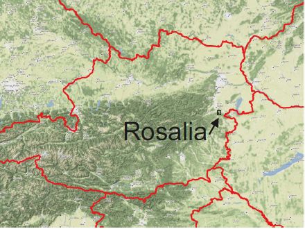
The Rosalia Mountains (German: Rosaliengebirge) belong to the eastern foothills of the Alps on the state border between Lower Austria and Burgenland in Austria. The terrain height ranges from 320 to 725 m a.s.l., and is characterised by very steep slopes. Crystalline rocks are dominating, but coarse grain gneiss, some sericitic schist, phyllite and dolomite are also encountered. Mean annual precipitation is approximately 700-800 mm. The watershed is almost completely forested with all major tree species and forest types in Austria, but spruce and beech are dominating. Forest practice has been changed to promote uneven aged mixed species stands.
Objectives
The main objectives are
- to collect data that support the study of transport processes in the system of soil, water, plants and atmosphere
- emphasis is on bridging the gap between point related measurements and effective values and parameters for watersheds
- generate comprehensive reference information for research projects on future management and climate change impacts
Operation is planned for a period of at least 10 years using only internal resources of the university
Main elements
Time series variables observed
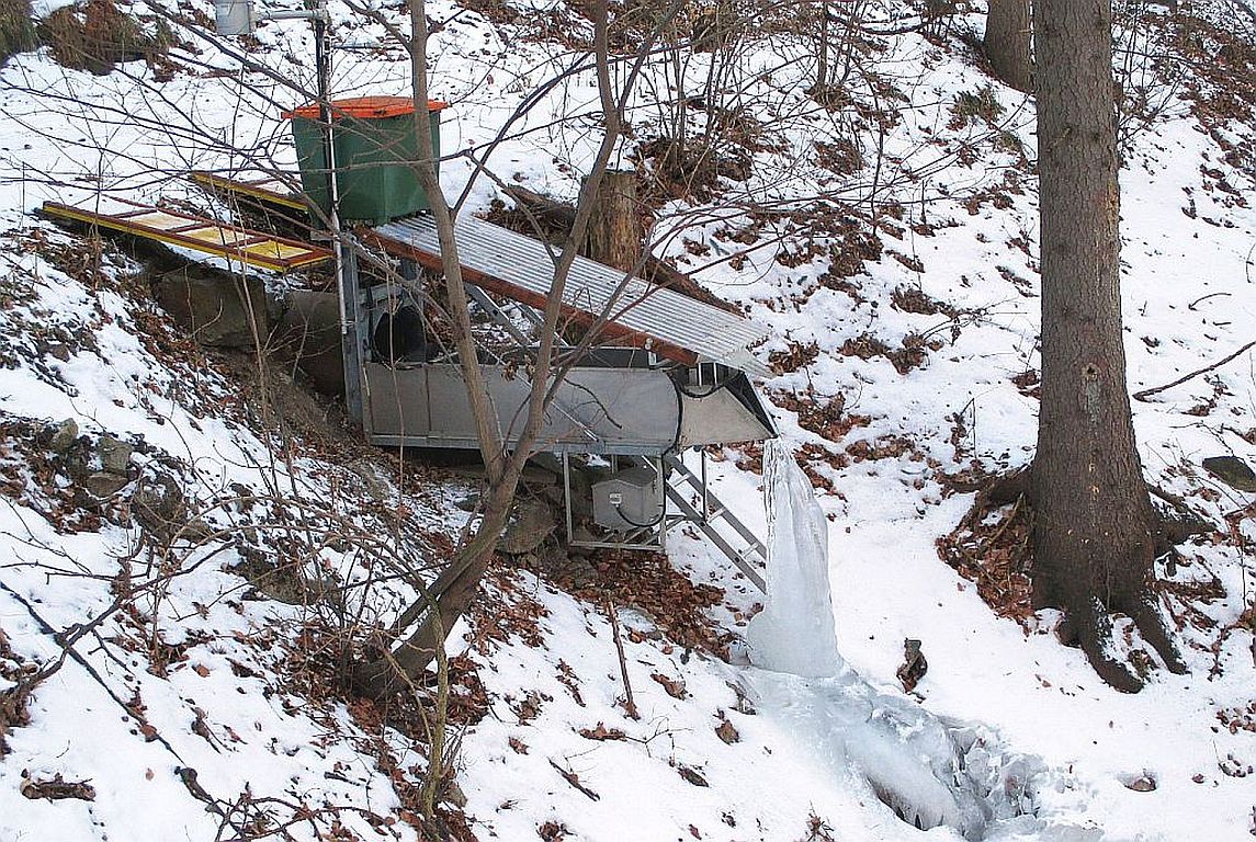
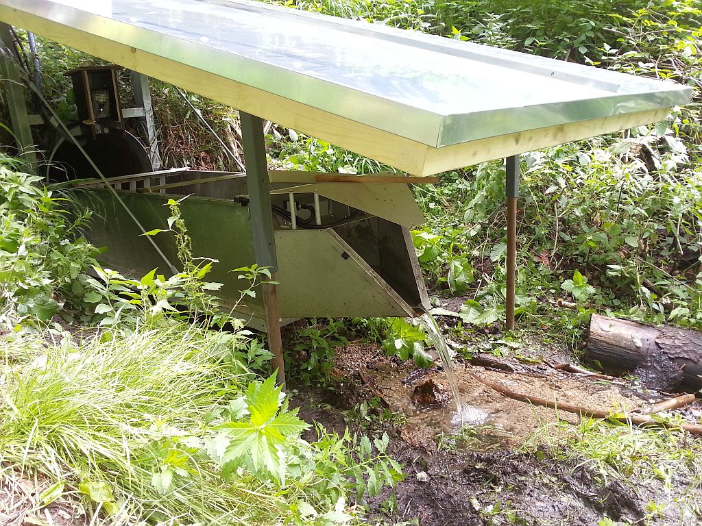
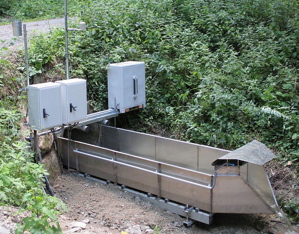
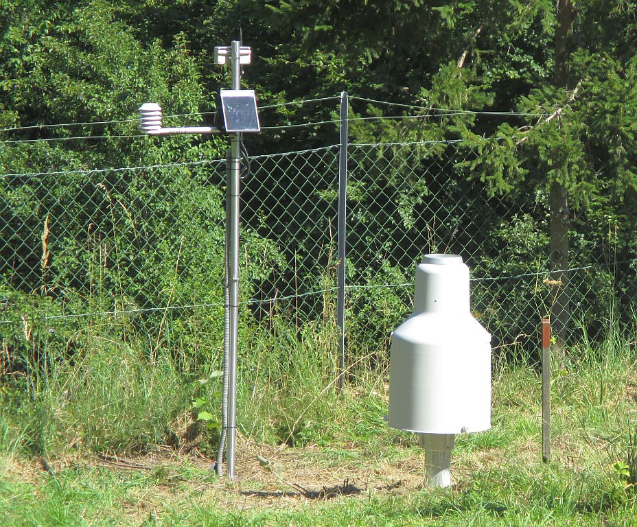
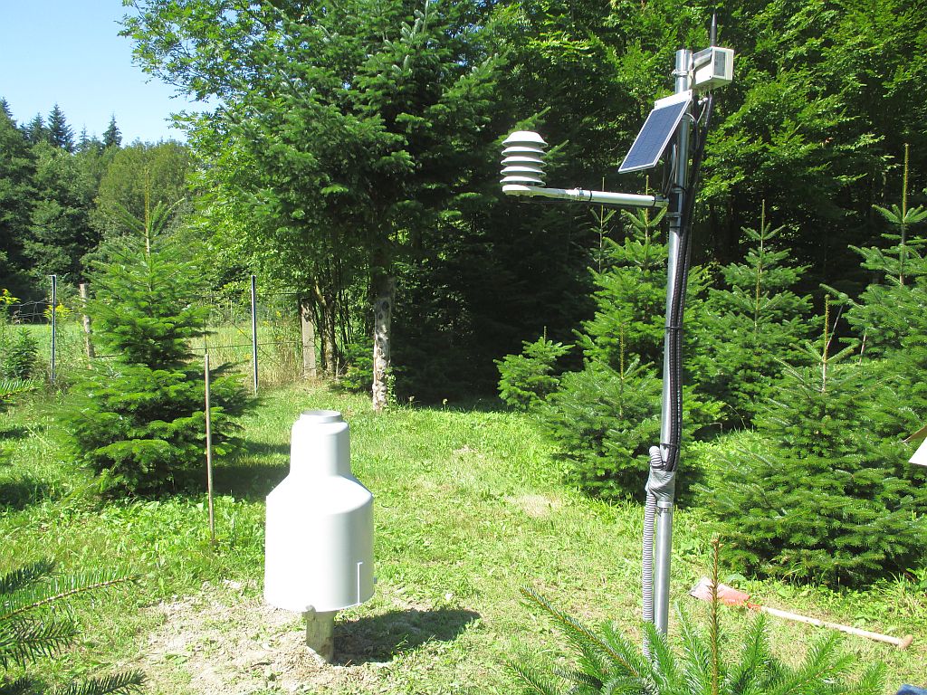
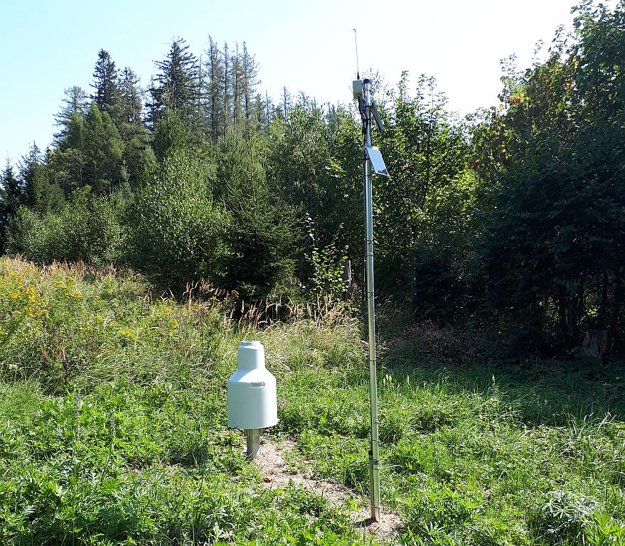
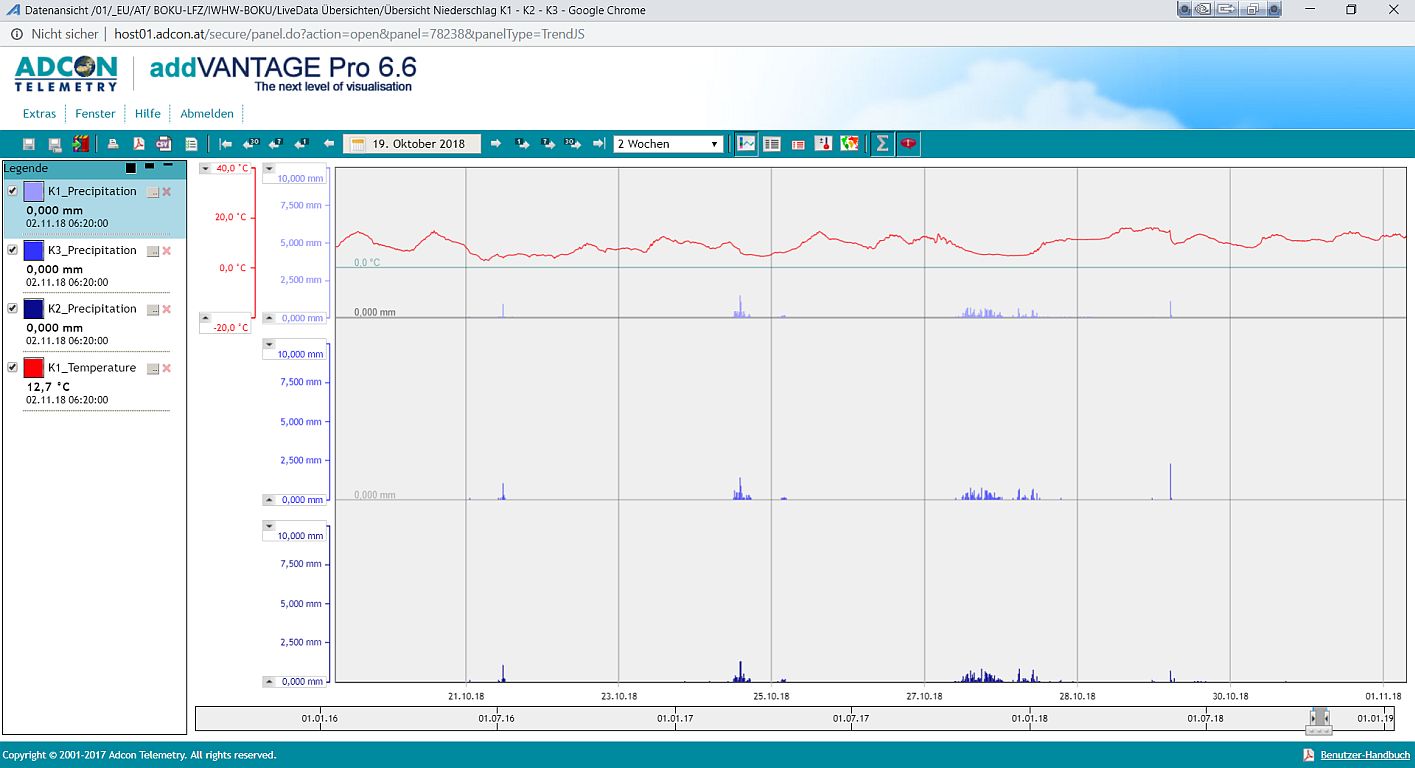
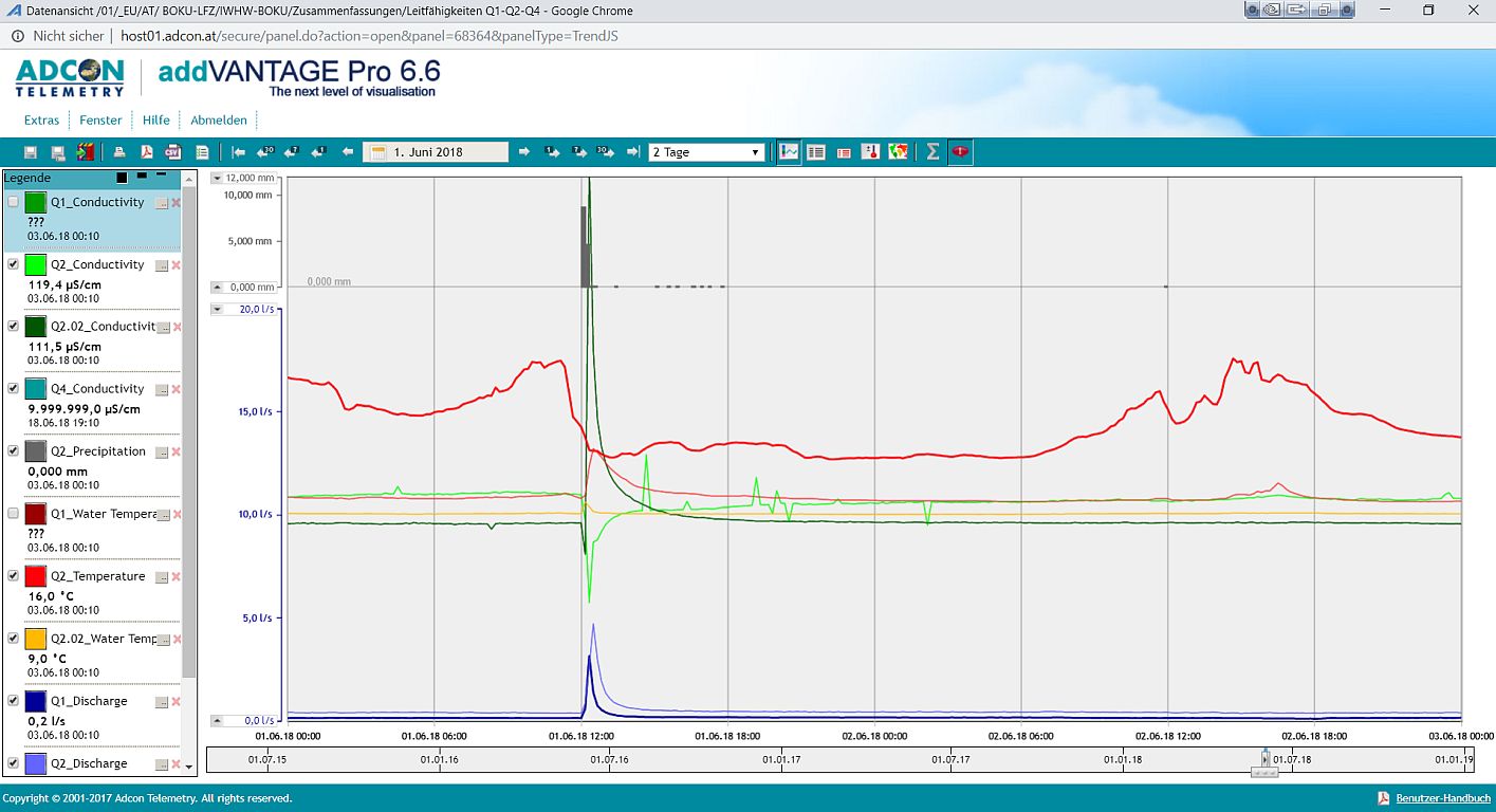
Monitoring of hydrometeorological data in a densified network of stations: river discharge, water and air temperature, relative humidity and electrical conductivity of water are monitored at 4 gauges. The locations were selected to cover nested sub-watersheds of 9, 27, 145 and 220 ha, respectively. Precipitation is measured by 7 rain gauges at different altitudes.
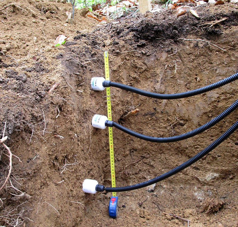
At four locations, soil profiles were installed where soil moisture and temperature are measured in four depths.
Water quality (NO3-N, TOC, turbidity) is monitored by a spectrometer probe in one location.
Data acquisition and management
- 10 min sampling interval
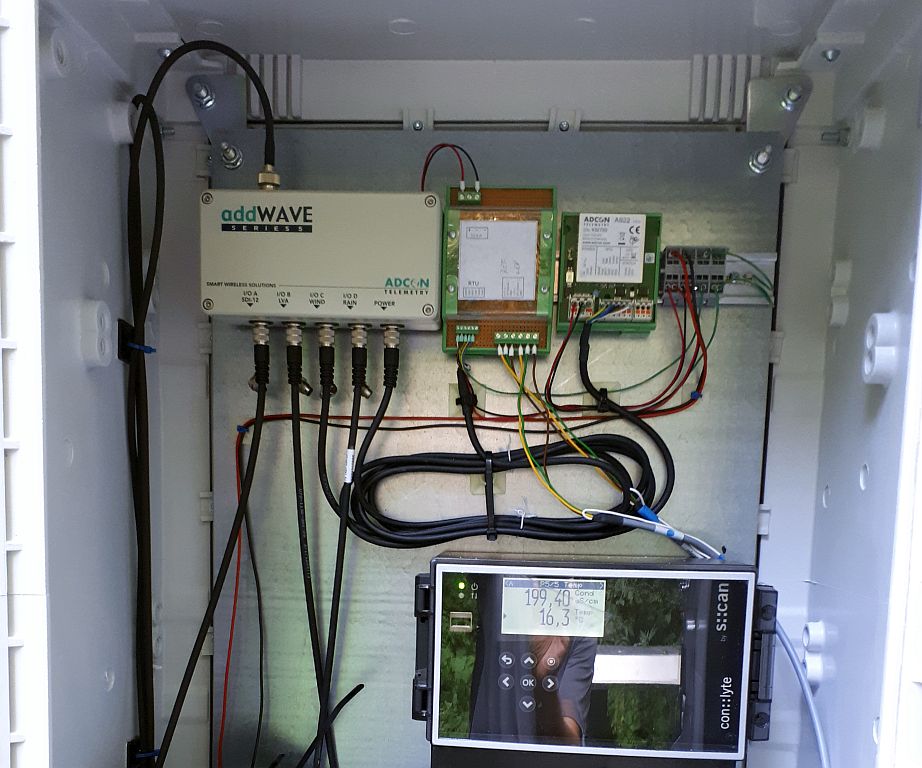
- UHF radio telemetry network with data storage and management in a web accessible DBMS (Adcon)
Monitoring of time series is complemented by terrestric surveys of soil properties during field courses of students and geophysical explorations. Topographic information is available from various DEM, including a 0.5 x 0.5m resolution LIDAR.
Contact:
Location

Monitoring sites

Data management
List of sites, sensors and observed variables
| Site | Sensors | Variables |
Q1
RTU A753 | Conductivity and temperature sensor Ponsel C4E | Electrical conductivity Water temperature |
| Rain gauge RG1 | 10-min rain depth 0.2 mm events | |
| Air temperature and humidity sensor TR1 | Air temperature Relative humidity | |
| 1-ft H-Flume with 2 ultrasonic distance sensors | Water level in H-Flume Discharge | |
| Tipping bucket device 1l | Small discharge | |
| 4 Hydraprobe II soil sensors | Soil water content Soil temperature Electrical conductivity of soil water | |
Q2
RTU A753
Q2S1 RTU A723 Q2S2 RTU A723 Soil water profiles | Conductivity and temperature sensor Ponsel C4E | Electrical conductivity Water temperature |
| Rain gauge RG1 | 10-min rain depth 0.2 mm events | |
| Air temperature and humidity sensor TR1 | Air temperature Relative humidity | |
| 1-ft H-Flume with 2 ultrasonic distance sensors | Water level in H-Flume Discharge | |
| 4 Hydraprobe II soil sensors | Soil moisture Soil temperature Soil water conductivity | |
| 3 Hydraprobe II at Q2S1 & Q2S2 | Parameters see above | |
| 2 SM1 Soil moisture and temperature probes at Q2S1 and Q2S2 | Soil moisture and temperature in 3 depths | |
K1
RTU A753 | Ott Pluvio² | 10-min rain depth 0.1 mm events |
| Air temperature and humidity sensor TR1 | Air temperature Relative humidity | |
| K2 Mehlbeerleiten RTU A753 | Ott Pluvio² | 10-min rain depth 0.1 mm events |
| Air temperature und humidity sensor TR1 | Air temperature Relative humidity | |
| K3 Krieriegel RTU A753 | Ott Pluvio² | 10-min rain depth 0.1 mm events |
| Q3 RTU A723 | Pressure sensor Keller PR46X | Water level at weir Discharge |
| Rain gauge RG1 | 10-min rain depth 0.2 mm events | |
| Air temperature and humidity sensor TR1 | Air temperature Relative humidity | |
| Q4 RTU A753 | 2-ft H-Flume with 2 ultrasonic distance sensors | Water level im H-Flume Discharge |
| Rain gauge RG1 | 10-min rain depth 0.2 mm events | |
| Air temperature and humidity sensor TR1 | Air temperature Relative humidity | |
| S::can Electrical conductivity- and temperature sensor condu:lyser | Electrical conductivity Water temperature | |
| S::can multi:lyser spectrometer probe | TOC, NO3-N, turbidity |