Research areas at HyWa
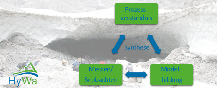
Research at HyWa
Research fields
Integrated Water Resources Management
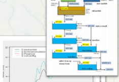
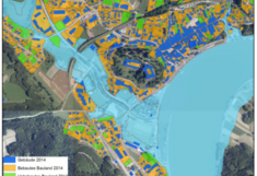
In the context of Integrative Water Management, HyWa develops methods and decision support tools for water quantity (flood and low flow) and water quality (temperature, nitrate, phosphorous etc.) management. In addition to the implementation of the EU Water Framework Directive and Flood Directive, climate change, land use change, inputs of environmental chemicals and demographic change are important environmental and social-economical boundary conditions that require interdisciplinary and transdisciplinary approaches.
Contact:
Groundwater management
The numerical modeling of groundwater flow in porous aquifers, which has been a focus of activity for many years, has become largely routine. Current issues relate to the extreme value statistical estimation of high groundwater levels and the assessment of groundwater temperature monitoring sites. In the experimental area Rosalia, the metrological recording and process description of the baseflow is a research objective, which belongs to the field of groundwater.
Selected publications:
Contact:
Alpine Hydrology
The mountain area plays an important role in the water supply of many parts of the world. At the same time, the mountains are particularly affected by global warming. At HyWa, we analyze hydrological processes in mountain areas with the help of established models, self-developed model approaches, remote sensing data sets, but also with self-collected measurement data from our research catchment area.
Selected publications:
Pomeroy, J; Bernhardt, M; Marks, D. (2015): Water resources: Research network to track alpine water.
Contact:
Regionalization Methods
The transfer or estimation of parameters that have been selectively measured or determined within a hydrological catchment to other locations or catchments is one of the biggest challenges in hydrology. HyWa combines multi-scale parameter regionalization methods with machine learning (machine learning) and remote sensing methods to estimate the mathematical structure and coefficients of parameter transfer functions directly from runoff data.
Selected publications:
Link to project: Parameter-regionalisation in hydrological models with Context Free Grammar
Contact:
Ecohydrology
Eco-hydrological models (e.g. SWAT) simulate water quantity whilst having a strong focus on water quality. Simulated variables such as discharge, nitrogen, phosphorus and sediment losses from agricultural non-point sources are particularly examined. These models are applied to selected Austrian and international catchments to answer a number of research questions related to:
- Climate change impacts
- Field adaptation measures
- Changes in crop systems and urban areas under anthropogenic influences (climate, agricultural policies, markets, etc.)
- Scenarios of future agricultural land use determined through driving factors and farmer decision-making processes
- Sensitivity and uncertainty analysis due to future scenario, parameter calibration and input data.
Informations and literature:
- Link zum Projekt UnLoadC3
- Link zum Projekt NitroClim.AT
- Multi-site calibration and validation of SWAT with satellite-based evapotranspiration in a data sparse catchment in southwestern Nigeria (Odusanya et al. 2018)
- Mehdi, B.; Ludwig, R.; Lehner, B. .
(2016): Simulated future changes of extreme nutrient loads in a mesoscale agricultural watershed in Bavaria
Die Bodenkultur: Journal of Land Management, Food and Environment, 67(2), 77-90; ISSN 0006-5471
Contact:
-
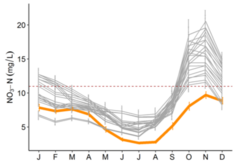
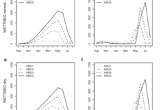
[Translate to English:] Nitrate-nitrogen concentration in-stream for future climate scenarios (grey lines) compared to current conditions (orange) (credit: B. Mehdi). -
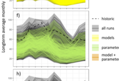
[Translate to English:] Monthly nitrate-nitrogen loads simulated with different model set-ups and parameters values (credit: C. Schürz). -

[Translate to English:] Monthly nitrate-nitrogen loads simulated with different model set-ups and parameters values (credit: C. Schürz).
Remote Sensing methods
At the HyWa, remote sensing techniques are used and developed. We obtain data from our own UAV, from LIDAR instruments or from satellites. So we can work very detailed on the local scale, or even trans-regional. The data sets of the individual sensors are also used in combination, e.g. to optimize / scale coarse-resolution satellite-based products. For evaluation, own algorithms or tool boxes are developed if necessary (e.g., PRACTISE), or modern tools such as e.g. Google Earth Engine are used.
Selected publications and projects:
FWF Project: Understanding and characterizing land surface - atmosphere exchange and feedbacks
Contact:
Model developement
COSERO (HyWa Rainfall Runoff model)
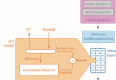
In the hydrological context, rainfall-runoff models provide an essential information basis for scientific and practice-relevant questions. In a scientific context, models are used, for example, to test and further develop hypotheses such as runoff generation processes or the spatiotemporal distribution of rainfall. Rainfall-runoff models are used in practice for the determination of floods, flood forecasting or the estimation of (seasonal) hydropower production. The COSERO rainfall-runoff model developed at HyWa is used, for example, by hydrographical services in Austria for flood forecasting or by hydropower provider for inflow forecasts. Further developments are taking place in COSERO in order to integrate new developments from science (regionalization methods) as well as practical requirements into the model with the aim to improve the simulations. In addition, other methods for hydrological modeling are also used and developed at the HyWa. Recent developments in the field of machine learning and the use of neural networks are, for example, adapted for the task of rainfall-runoff modeling.
Contact:
Modelling the Cryosphere
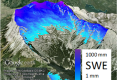
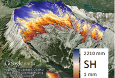
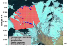
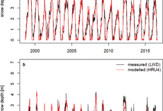
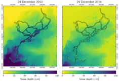
At HyWa, a whole model suite is used to simulate or forecast relevant processes for the hydrological cycle in the cryosphere, primarily the models Alpine3D, CRHM and NoahMP. For these models, additional routines such as e.g. SnowSlide are developed. We are interested in the question how different model approaches perform under different framework conditions (topography, climate, data situation) and how the use of input data from other models or of remote sensing data sets can affect the quality of the prediction.
Anthroprogenic influences are considered. Thus, the implemented model approaches, e.g., take into account the snow and slope management in ski areas and reveal optimization possibilities for management.
Selected publications:
Massmann, C (2019): Modelling Snowmelt in Ungauged Catchments
Frey, S; Holzmann, H (2015): A conceptual, distributed snow redistribution model
Contact:
Ecohydrological Modelling
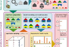
Using several data factors (i.e. climate simulations, land use scenarios, or non-unique parameters) as input into eco-hydrological models requires an evaluation of the sensitivity and related uncertainty of each factor. The development of an uncertainty estimation framework for the SWAT model [BM1] is currently underway and is on-going research.
Selected publications:
Contact:
Regional downscaling
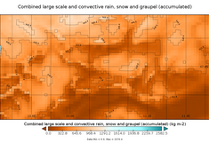
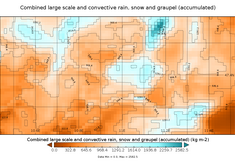
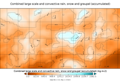
The model ICAR of the National Center for Atmospheric Research (NCAR) is used at HyWa for regional climate modeling. ICAR is a simplified three-dimensional atmosphere model. Heat and moisture flows are determined via a circulation field modified by the linear mountainwave theory, which can be calculated from the hosting model e.g. ERA Interim original field. The adoption of the circulation dynamics from the coarse-scale atmospheric model represents the essential difference to more complex regional climate models (RCMs) such as WRF. This approach avoids the need to directly solve the Navier-Stokes equation for motion in ICAR, which is traditionally the core representing RCMs. However, in order to conserve the mass and to compensate for local spatial imbalances in the wind field, the vertical air movement is additionally calculated. This happens to avoid numerical problems with convergent wind currents. Other formulations in ICAR are similar or identical to those in more complex RCMs. Due to the mentioned adaptations, ICAR is orders of magnitude faster than e.g. WRF and thus allows sensitivity analyzes and the study of various model descriptions e.g. of microphysics, over longer periods of time. ICAR also provides HyWa with high-resolution climate data udes in regional hydrological studies.
Selected publications:
Contact:
Big Data – Machine Learning
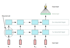
“Big Data” refers to data sets that are too large or complex for traditional statistical analytical methods and software. In environmental sciences Big Data are a result of new mapping and monitoring techniques, such as satellite remote sensing or geophysical methods that produce (continuously) large amounts of measurements. For big data analysis, methods from “Machine Learning (ML)” are applied to extract complex structures and patterns within these data. ML includes sophisticated statistical methods as well as a wide range of “Artificial Neural Networks (ANN)”. They focus on the development of models to predict complex relationships between input and output variables that are learned directly from training data.
HyWa applies methods from ML and ANN to describe complex rainfall-runoff behavior that is learned from large input-output data sets. ANNs are also used for parameter regionalization and for land use and land cover classification from remote sensing data.
Selected publications:
Contact:
Extreme events
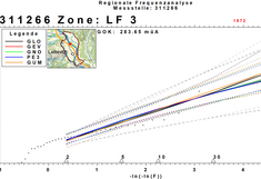
The determination of recurrence probabilities in the area of flood risk management represents a complex topic. The results of the currently used statistical methods are not very robust due to the comparatively short runoff time series. Furthermore, climate change and the anthropogenic influence on the catchment characteristics makes a stable prognosis of e.g. HQ100 values difficult. At the HyWa we are therefore intensively occupied with "upper bounded" statistical procedures, which assume a defined upper limit for flood events in catchment areas.
Selected publications:
Contact:
Measuring technology
Distributed Temperature Sensing (DTS)
The distributed temperature sensing (DTS) using fiber optic cables is based on the Raman effect. A transmitted light pulse is scattered differently depending on the temperature along the cable. In this way, temperature measurements up to 10km cable length in high spatial (0.25cm) and temporal (seconds) resolution with high precision (up to 0.01K) are possible. The technology is currently used e.g. for the development of methods for the analysis of groundwater flowing water interactions, melt dynamics of snowpacks, leak detection of drainage pipes in lakes and soil water content.
Selected publications:
Contact:
HyWa UAV system
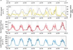
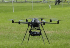
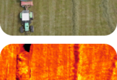
The HyWa has its own unmanned aerial vehicle (UAV) system. The UAV is equipped with an RGB and a thermal camera. The UAV is used for recording high-precision DEMs, monitoring surface temperatures and deriving snow depths. A special focus is on the calculation of the current evaporation over different vegetation types. Various model approaches are simultaneously used. Our studies have shown that the evaporation rates measured with the help of the UAV are in the same range of accuracy as Eddy Flux or scintillometer measurements.
Selected publications:
Contact:
Hydrometeorological measurement techniques
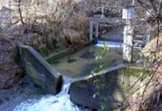
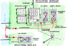
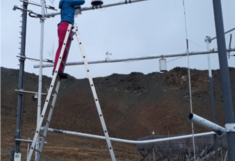
The HyWa has extensive know-how and equipment. Depending on size and flow condition, we carry out ad hoc flow measurements in surface waters by means of salt dilution methods, current meter, a flow tracker or a ADCP. In the field of mobile observation of the unsaturated zone we use TDR devices. The focus of our scientific research is Rosalia (Rosalia), which currently has 7 precipitation gauges (including air temperature and humidity), 4 discharge gauges, 4 soil water balance profiles and an online spectrometer to monitor nitrate, TOC, turbidity and conductivity in place. The research at Rosalia is done in part in cooperation with other BOKU institutes. The data of all these sites are recorded telemetrically via a wireless network and are available via a comfortable web based database management system.
Kontakt:
Snow measurements with GNSS sensors
In-situ snow measurements provide essential information for various hydrological applications and are important for validation or calibration of models and remote sensing products. With the novel sensor system SnowSense®, it is possible to derive snow water equivalent (SWE) and snow liquid water content (LWC) continuously and non-destructively based on carrier phase measurements and signal strength information of the freely available signals of the Global Navigation Satellite System (GNSS), such as GPS and Galileo, and dielectric properties of dry and wet snow. To derive the snow cover properties, the signal time delay and attenuation are obtained from the signal differences of carrier phase measurements and signal strength between a low-cost GNSS sensor buried below the snowpack and a reference sensor above the snow cover. So far, the GNSS-based results were tested and validated at the high-alpine SLF site Weissfluhjoch (2540 m a.s.l.) in Eastern Switzerland, and at a site in the Canadian subarctic. Currently, this measurement method is also tested in further regions and at different altitudes, where the snow cover is shallower and snowmelt and refreezing processes as well as rain-on-snow events occur more frequently. Apart from hydrological applications, we also aim to employ this technique in avalanche-prone slopes and for technical snow management in terms of snow quality predictions in alpine skiing resorts.
Selected publications:
Contact:
Scientific networks
GEWEX INARCH
INARCH is a GEWEX cross-cutting network, affiliated with the Global Hydroclimatology Panel (GHP), the International Association for Hydrological Sciences (IAHS), the Commission for Snow and Ice Hydrology (ICSIH), the UNESCO IHP-VIII - Water Security Program, and the Changing Cold Regions Network (CCRN).
The aim of the network is to connect the few high-alpine research locations, to standardize their data bases and to make data accessible, as well as to improve existing model approaches and to check their transferability.
Selected publications:
Contact:
Euro-mediterranean Network of Experimental and Representative Basins (ERB)
The Euromediterranean Network of Experimental and Representative Basins (ERB) is an open association of 22 European countries operating and managing well instrumented experimental and representative basins for hydrological and environmental research on a long term basis. Currently ERB is coordinated by a member of the IWHW-BOKU.
ERB has just launched its new homepage. Here you will find further information about the objectives of ERB, past initiatives like the organization of joint conferences and basin inventories and links to related networks. http://erb-network.simdif.com
Contact:

