Keys to Integrated Extreme Events Management
The approach presented enables researchers, managers and practicioners to better communicate and find solutions through effective collaboration. Key roles play here the Understanding Soil Processes and Ecosystem Services at various scales.
Renschler’s research at the BOKU combines two of his major contributions: the Geospatial interface for the Water Erosion Prediction Project (GeoWEPP), a geographic information systems (GIS) software tool and the PEOPLES Resilience Framework. Both enable to assess the impact of climate and land use/cover change on runoff, soil erosion and flood dynamics and to design more integrated watershed management strategies for sustainable development and more resilient communities.
June 10 2016, 9:00-10:00 Exner-Haus, Peter-Jordan-Str. 82, 2. OG, EG 05
Geospatial Project Management (GeoProMT) is also introduced to better analyze and assess geo-spatial physical and non-physical processes in landscapes (a special course on this starts on May 25 2016 and registrations are still possible; see link below).
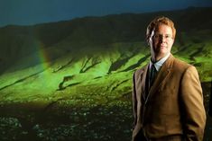
Chris Renschler, Associate Professor in Geography at the University at Buffalo - The State University of New York, USA, is currently Fulbright Visiting Professor at the BOKU through the end of June 2016. More information: BOKUonline

