The Core Facility LILA aims to innovatively advance spatial and landscape-related research and make it accessible and usable for all age groups, population groups, and decision-makers.
Whether you are a research group, company, or student: Would you like a demonstration or are you interested in a collaboration? Feel free to contact us! You can find more information about equipment and available services here!
Digitization of spatial and landscape-related data
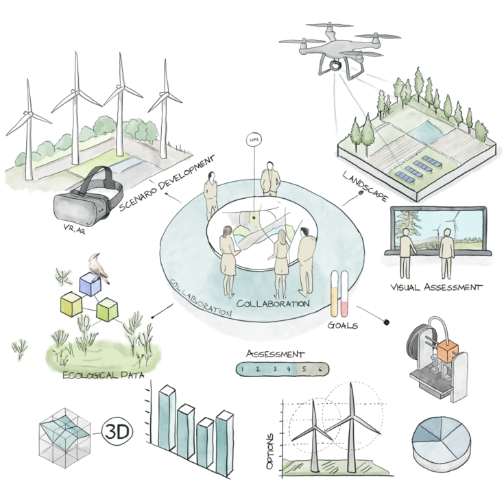
We support you in preparing historical map material, capturing new, high-quality spatial data using modern technologies such as 3D laser scanners with LIDAR or drones, and evaluating this data using machine learning in combination with big data.
Representation and interaction with spatial data
We offer several ways in which processed data can be visualized or experienced. To promote innovative approaches to landscape visualization, classic visual representation can be expanded to include more immersive experiences—for example, through VR or AR glasses, or the simultaneous display of the landscape on a LED wall from a first-person perspective in a real-time simulation engine.
This not only enables research into the effects of landscape changes on human health (heart rate, skin conductance, etc.), but also simplifies participatory decision-making, as multiple aspects can be highlighted and presented in a way that is understandable for different age and population groups.
The simulation engine we use also supports the playful placement of entities and their effects in real time, making it an effective tool for rapid iteration. By incorporating different data sets (e.g., animal populations, water bodies, agricultural use, vegetation, and topography), a wide variety of projects can benefit from our software and easily visualize their effects.
Creating physical objects from digital data
A key component in evaluating landscape changes resulting from construction projects is the creation of physical models models, which can be easily produced using our 3D printers or laser cutters and then enhanced with AR information.
Whether it's collecting data, creating statistics, or visualizing data using new technologies such as AR/VR or simulation software: Our focus is on enabling collaboration between decision-makers from all population groups, who can gain a comprehensive impression through the perception of different sensory inputs and thus be able to make sustainable decisions.
Open Source
We pursue an open access and open innovation approach and therefore promote the use and publication of open source data.