APPEAR Project Edu4GEO2


Implementation of Academic Geomatics Education in Ethiopia for Supporting Sustainable Development (Edu4GEO2)
APPEAR Project 310 AAP
Project Duration: 01.03.2023 - 28.02.2026 (extended until 30.06.2027, due to civil unrest in the Amhara region)
Ethiopia has launched a land-related data capturing and processing program using ground survey equipment, aerial photography as well as high-resolution satellite imagery. The recently established Rural Land Administration Directorate (Ministry of Agriculture), the Urban Land Development and Management Bureau (Ministry of Urban Development and Construction) and the Geospatial Information Institute at federal level with branch offices at regional and lower organizational levels are responsible for all geodata-management tasks. However, the lack of well-qualified specialists is becoming a challenge for a proper execution of these duties.
APPEAR has been playing pivotal role for these by funding the establishment and proper functioning of the land administration competence center at Debre Markos University (DMU) in the previous academic partnership project EduLAND2. A bachelor course on Land Administration and Surveying has been developed and implemented to teach students both in regular and continuing education programs. In addition, land administration experts at different levels got tailor-made trainings on different skill related courses.
Edu4GEO2 is based on the results of EduLAND2 project and designed to upgrade the competence of undergraduate students through implementing a master curriculum on Geomatics to make students fit for leading positions in the public and private sector of land administration and geodata-management, as well as for teaching and research activities at academic institutions. Since, female students are given priority in the enrollment process, Edu4GEO2 will increase the number of female land administrations specialists. This will improve the proportion of female land administration professionals engaged in higher scientific works and decision-making powers.
The implementation of the master course relies heavily on team-teaching. During the first and the second term of the master program, all classes are held as team-teaching of the project members from all partner institutions. From the third term on, lecturers of DMU will take over and provide classes by their own (in a team-teaching approach). Team-teaching enables lecturers to learn from each other by discussing and applying modern teaching and learning methods. It perfectly integrates the concept of gender and diversity. The course material will be available in digital format.
Two research studies will be carried out in the Edu4GEO2 project. One is highlighting the potential of Unmanned Aerial Vehicles (UAV) to gain land related information time-independently at local level. The second is investigating the effects of land certification on balancing gender land rights. Factors triggering gender equality will be elaborated and communicated to the public. Together with trainings given to female farmers and the increased number of higher-qualified female land experts, the findings of this research study will strengthen the land tenure security for women in the Ethiopian society and create a conducive environment for equal access to land.
Edu4GEO2 also includes customized trainings for land administration professionals engaged in different scientific works, which will close existing knowledge and skill gaps. Particularly, the training of land committees and female farmers is pivotal for the proper functioning of the land administration activities especially at the grass root level.
Edu4GEO2 directly addresses the overall objective of APPEAR, as it increases capacity in the land administration sector by producing competent graduates, by upgrading knowledge and skills of project team members and land administration professionals, and by conducting problem solving research.
Edu4GEO2 is in line with the priority areas of the government and will be an essential contribution for the achievement of the UN Sustainable Development Goals.
Project Partners:
Technische Universität Wien (TUW)
Debre Markos University (DMU)
Bahir Dar University (BDU)
BOKU-Staff involved:
Thomas BAUER (IGEO)
Emma IZQUIERDO-VERDIGUIER (IGEO)
Reinfried MANSBERGER (IGEO)
Franz SUPPAN (IGEO)
Doris DAMYANOVIC (ILAP)

 Institute of Geomatics")
 Institute of Geomatics")
 Institute of Geomatics")

Activities in Progress or Completed (updated: July 7, 2026)
WP1 Project Management
- Meetings:
- Kick-Off-Meeting (May 9, 2023) at TUW
- Project Meeting 2 (October 25, 2024) at AAU (Addis Ababa University)
- Project Meeting 3 (October 26, 2025) in Hotel IVY (Addis Ababa)
- Reports:
- Half-Year Report Year 1, Year 2, Year 3
- Annual and Financial Report Year 1, Year 2 and Year 3
WP2 Development and Running the MSc Curriculum
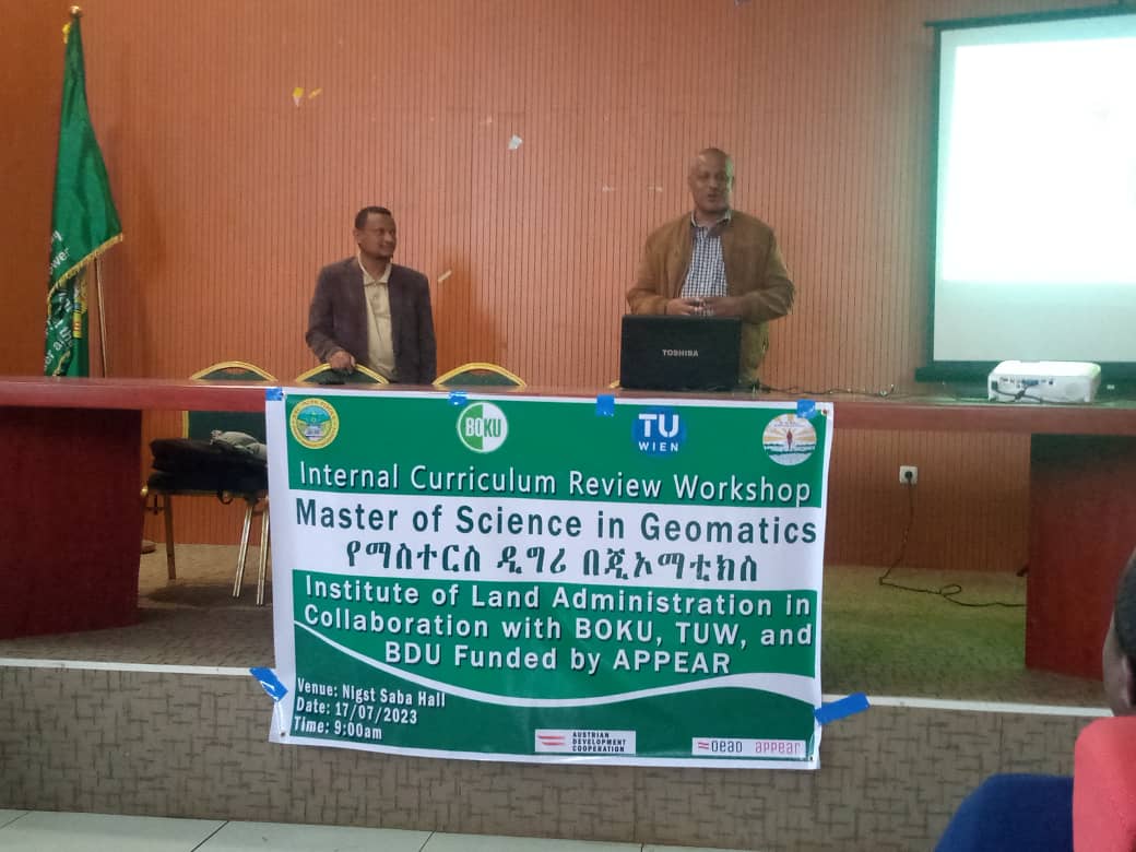
- Review of the existing national MSc curricula on the topic of "Geomatics"
- Curriculum design for MSc program "Geomatics" (draft - to be approved by DMU management; see pdf)
WP3 Provision of Teaching & Research Facilities and Learning Materials
- Acquisition and purchase of photogrammetric & surveying equipment - delivered end of April 2025
- Acquisition and purchase of facilities for online and hybrid teaching - delivered end of April 2025
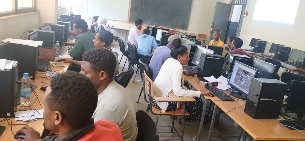
- Acquisition of computers for lab - delivered mid of May 2025
- Acquision and purchase of CORS (Continuously Operating Reference Station) - delivered November 2025 (construction and installation under progress)
WP4 Capacity Building, Training and Education
- Workshop "Development of digital teaching and learning material"
(held as Zoom-Conference in September 24-25, 2024) - Launch of Master Study Program at DMU in October 2024
(six students, one of them female) and in October 2025 (seven students, three of them female) - Delivery of Courses for MSc students at DMU by Austrian teachers
(1st year, 1st semester 2024/25; 2nd year, 1st semester 2025/26)- Fundamentals of land administration (AGEGNEHU / ALEMU) – 3Cr
- Spatial statistics and adjustment computations (NAVRATIL / NIGUSE) – 3C
- Analysis of remote sensing data (IZQUIERDO / ABRAHAM) – 3Cr
- Advanced GIS (GEDEFAW / EPHRATA) – 3Cr
- Reference systems, coordinate transformation and map projection (BAUER / TAKELE) – 2Cr
- Delivery of Courses for MSc students at DMU by Austrian teachers
(1st year, 2nd semester 2025, 2nd year, 2nd semester 2026)- Cadastral surveying and land registration (SISAY / NIGUSE) – 3Cr
- Spatial data analysis and data quality (ALINAGHI / ABRAHAM) – 2Cr
- Applied photogrammetry (MANSBERGER / AGEGNEHU) – 3Cr
- Satellite and physical geodesy (TULU / TAKELE) – 3Cr
- Research methods (GEDEFAW / FENTIE) – 3Cr
- Delivery of short-term trainings for Ethiopian LA staff:
- Map projections, reference systems and transformations (BAUER / TAKELE)
(February 18-21, 2025) - Photogrammetry (MANSBERGER / AGEGNEHU)
(December 16-18, 2025) - Spatial Statistics and adjustment computation (NAVRATIL / NIGUSE)
(February 16 -18, 2026)
- Map projections, reference systems and transformations (BAUER / TAKELE)
WP5 Joint Research Activities
- Case Study on “Data Acquisition using UAV to support land administration tasks”
(launched in October 2025 - ongoing activity) - Case Study on “Impact of land certification on balancing gender land rights”
(investigations done in Q2 & Q3 / 2025, results presented at Worldbank Conference 2026 - see WP 9)
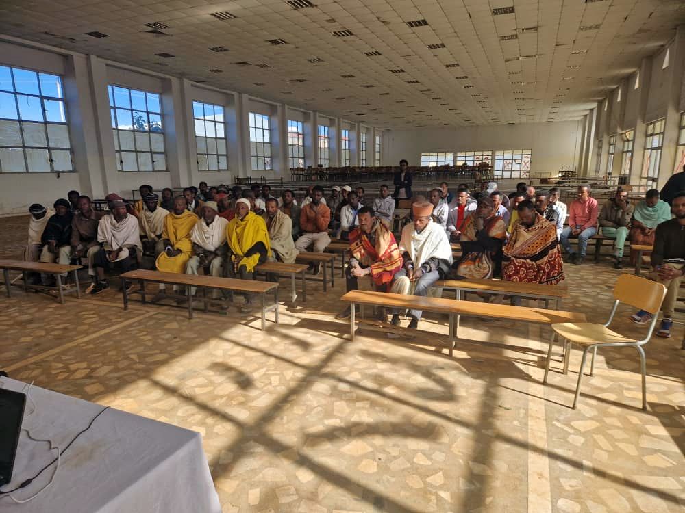
WP6 Provision of community services
- Delivering training for local community
provided by Institute of land Administration, DMU- Training on Rehabilitation of expropriated farmers
(January 4-5, 2025) - Training on Rehabilitation of expropriated farmers, particularly female farmers
(March 7-8, 2026)
- Training on Rehabilitation of expropriated farmers
WP7 Dissemination
- Development and maintenance of project website
- Fact Sheet of project (see pdf)
- Roll-Up of the project (see jpg or pdf)
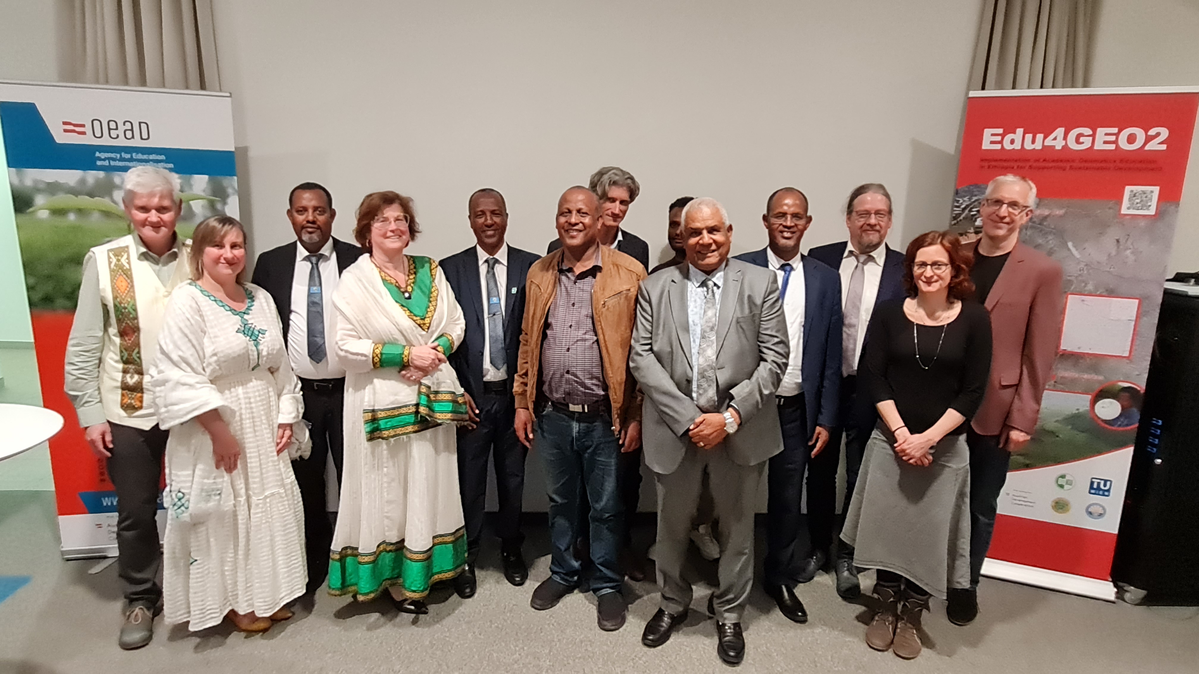
- APPEAR in Practice (May 9, 2023) in OeAD Building, Vienna (see APPEAR-Homepage)
- Welt im Ohr (May 30, 2023) 'Land rights and their importance for sustainable development' (Radio Broadcast)
- Publication of three articles in Journal LAND
- Gedefaw A, Desta M, Mansberger R. Impacts of Integrated Watershed Management Interventions on Land Use/Land Cover of Yesir Watershed in Northwestern Ethiopia. Land. 2024;13(7):918. doi:https://doi.org/10.3390/land13070918
- Agegnehu S, Mansberger R, Shita M, Nurie D, Mengesha A. Land Rental Transactions in Ethiopian Peri-Urban Areas: Sex and Other Factors for Land Rent Transactions. Land. 2024;13(9):1344. doi:https://doi.org/10.3390/land13091344
- Shita M, Agegnehu S, Fentie D, Dires T, Navrati G. Factors Affecting Food Security of Expropriated Peri-Urban Households in Ethiopia: The Case of the East Gojjam Administrative Zone. Land. 2024; 13(11):1779. doi:https://doi.org/10.3390/land13111779
- Tenaw M, Gugerell K, Agegnehu S, Bauer T, Mansberger R, Stöglehner G. Informal settlements lock-in: Drivers, impacts, and pathways to sustainable urban development-A thematic review. Cities. 2026;174:107092. doi:https://doi.org/10.1016/j.cities.2026.107092
- Enyew, F. F., Agegnehu, S. K., Bauer, T., Fischer, T., Mansberger, R., & Stoeglehner, G. (2026). Towards Sustainable Urban Development: A Systematic Review of Challenges in Urban Infrastructure Planning and Development in the Global South. Land, 15(6), 966. https://doi.org/10.3390/land15060966
- Presentation and publication of three papers at the International Conference on Urban Planning and Regional Development in the Information Society (REAL CORP), held at Vienna from
- Zewale H,L, Shita, W.M., Navratil, G.; Spatial Variability of Urban Land Price in Addis Ababa, Ethiopia
doi: 10.48494/REALCORP2026.4021 - Shita, M.S., Zewale, H.L, Navratil, G.:Spatial Determinants of Urbanisation in Debre Markos, Ethiopia: Modelling Building Footprint
doi: 10.48494/REALCORP2026.8022 - Navratil G., Mansberger R., Bauer T., Gebrie G.. Alemu B.Y., Getanhun Z., Mengistu A.M., Lisec A., Agegnehu S.K., Wężyk P., Krawczyk W., Szostak M.: Training of Experts for Sustainable Use of Land
doi: 10.48494/REALCORP2026.8045
- Zewale H,L, Shita, W.M., Navratil, G.; Spatial Variability of Urban Land Price in Addis Ababa, Ethiopia
- Presentation and publication of two papers at the World Bank Conference on Land and Property, held at Washington D.C. from April 29 to May 1, 2026.
")

 of the Edu4GeoTraining")


Next and Future Activities (Status: July 7, 2026)
WP1 Project Management
- Preparation of Half Years Report YEAR 4
- Preparation Annual and Financial Report YEAR 4 (Final Report)
- Project Meeting 4 - scheduled in Q1 / 2027
WP2 Development (finished) and Running the MSc Curriculum (ongoing, organised by DMU)
WP3 Provision of Teaching & Research Facilities and Learning Materials
- Installation of CORS-Station at DMU - ongoing
WP4 Capacity Building, Training and Education - finished
WP5 Joint Research Activities
- Case Study on “Data Acquisition using UAV to support land administration tasks” - ongoing
- Preparation of proposal for a follow-up research project - scheduled in Q3 / 2026
WP6 Provision of community services
- Delivering training for local community (farmers) - 3rd training
WP7 Dissemination
- Maintainance of Homepage - ongoing


Projektleiter und Kontaktperson BOKU
Thomas Bauer, Mag.Dr.rer.nat.
- Senior Lecturer
- Institut für Geomatik
- t.bauer@boku.ac.at
- Telefon
- +43 1 47654-85713
- Fax
- +43 1 47654-85709
- Postadresse
-
Geomatik
Peter-Jordan-Straße 82
1190 Wien - Sprechstunde
- Montag bis Freitag (nach Vereinbarung)