Projects of the Institute of Forest Growth
Permanent inventory sampling
Permanent inventory sampling
| Activity Title | Permanent inventory sampling at 554 sampling points since 1989 |
| Contact Person | Christoph Gollob |
| Duration of activities | 1989 - |
| Funding agency/Project | |
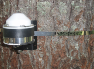
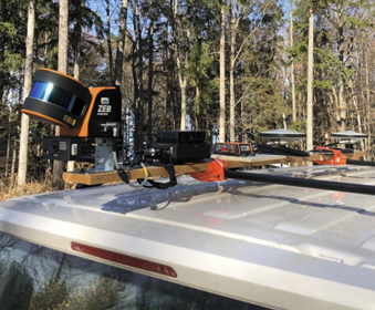
| Equipment installed in the field | Laserscanner |
| Brief description of activities | Tree detection and individual tree segmentation from laser scan data |
| Other relevant persons |
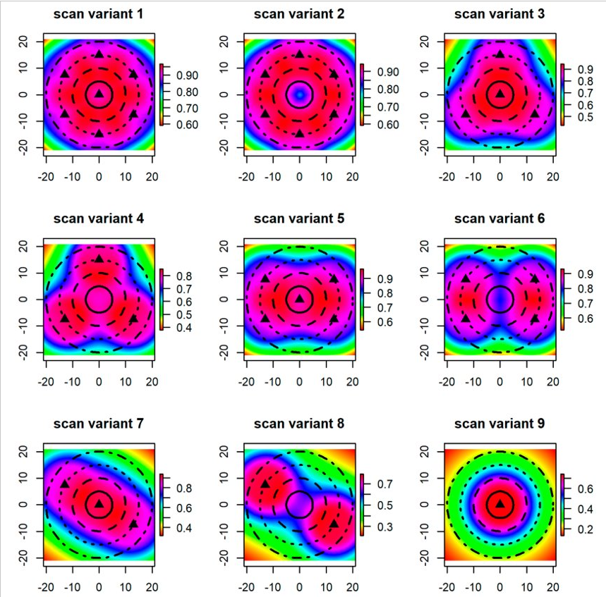
Modeled detection probabilities for different laser scanner installation variants. The laser beams emitted by the laser scanner cannot penetrate solid matter (tree trunks, branches, leaves, etc.). As the distance from the scanner increases, shadowing becomes more prevalent, resulting in a decrease in detection probability, i.e., the probability of overlooking objects increases with increasing distance from the scanner. This effect can be reduced by setting up the scanner in several positions. At WAFO, a statistical method was developed for modeling the detection probabilities of trees when using terrestrial laser scanning at forest inventory sampling points, which allows the scan positions to be selected in such a way that optimal coverage of the area is achieved.
Digitization of the Sample Inventory 2021
| Activity Title | Digitization of the Sample Inventory 2021 |
| Contact Person | Christoph Gollob |
| Duration of activities | 2021 |
| Funding agency/Project | |
| Equipment installed in the field | |
| Brief description of activities: | Sampling methods for digital forest inventories |
| Other relevant persons: |
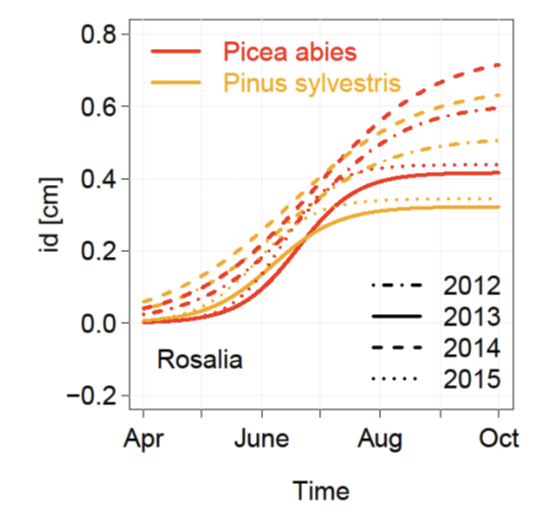
Dendrometer
Dendrometer
| Activity Title | Dendrometer |
| Contact Person | Christoph Gollob |
| Duration of activities | 2011 - |
| Funding agency/Project | |
| Equipment installed in the field | Dendrometer |
| Brief description of activities | Automatic tree species recognition |
| Other relevant persons |
Digitalisation of the Forest Road Network
Digitalisation of the Forest Road Network
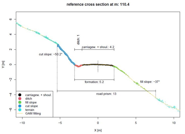
Monitoring forest roads with mobile laser scanning: automatic identification and measurement of cross sections.
Based on mobile laser scan data, 52 km of forest roads in the Rosalia teaching forest were digitized.
The resulting “digital twins” make it possible to obtain a wide variety of information about the forest roads, including their exact location, lane width, embankment slopes, etc.
| Activity Title | Digitalisation of the Forest Road Network |
| Contact Person | Christoph Gollob |
| Duration of activities | 2023 - |
| Funding agency/Project | |
| Equipment installed in the field? If YES, where? | Mobile Laser scanning unit |
| Brief description of activities: | Monitoring forest roads with mobile laser scanning: automatic identification and measurement of cross sections. |
| Other relevant persons: |
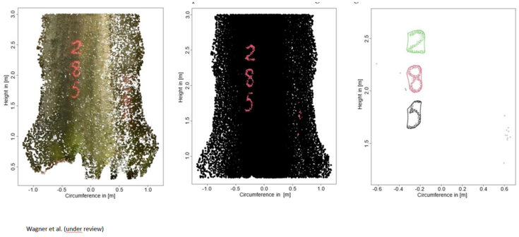
Automatic detection of color markings on trees
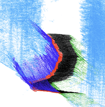
Automatic detection of color markings on trees.
Foresters often mark trees with spray paint, e.g., to designate skid trails, mark trees for removal, or mark anchor trees for cable routes. At WAFO, in collaboration with FT, a method was developed that allows these markings to be automatically detected using laser scanning point clouds, thus digitizing the information stored by foresters in the forest.
Left: colored point cloud from the laser scanner. Center: detection of spray paint. Right: detection of individual symbols (numbers in this example).