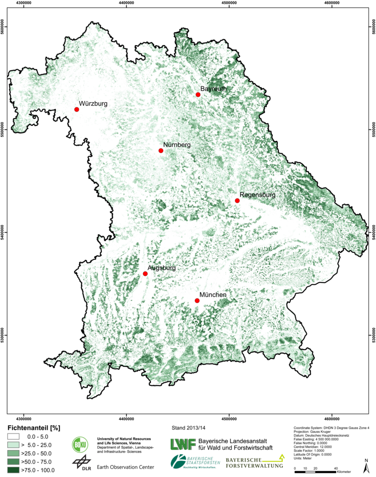
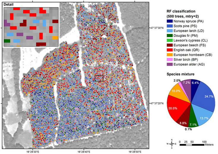
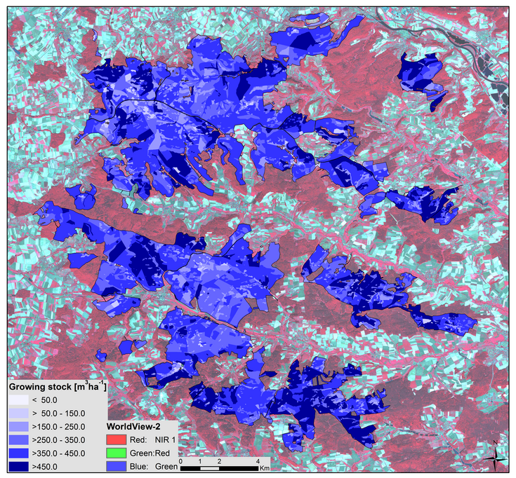
Forest remote sensing at the Institute of Geomatics focuses on classifying and assessing quantitative measures with remote sensing data of various special, temporal and spectral resolutions. Propose of our research is to provide products on different scales: reaching from tree species maps on singletree level, to regional growing stock maps, to large-scale maps; e.g. the fractional coverage of spruce in Bavaria, Germany. Further, we combine different methods for monitoring forest health/vitality and forest disturbances, e.g. detection of windthrow or bark beetle infestation.
The applied remote sensing data includes different, mainly optical sensors reaching from satellite borne data (MODIS, Landsat, Sentinel-2, RapidEye, Pléiades, WorldView-2,...), airborne data (multispectral cameras, hyperspectral sensors, laser scanner) to UAV-born systems (multispectral and thermal cameras).
Besides using single data sets, we try to utilize the potential of multi-view (3D data, BRDF), multi-temporal (time series) and multi-sensor data. For data analyses we increasingly use machine learning algorithms (Neuronal Networks, Support Vector Machines, Random Forests) besides of well-established methods. In addition to (semi-)empirical models we apply physically-based models (Radiative Transfer Model).
Our research is carried out in close cooperation with national and international partners in research- and industry. Among those are universities, research institutions, public authorities, forest enterprises and engineering offices.
Following courses held at the institute cover the topic forest remote sensing: ‘Introduction to Remote Sensing in Forestry‘, ‘Selected Topics of Geo-data Management‘‚ ‘Remote Sensing and GIS in Natural Resource Management‘, ‘Applied Photogrammetry‘, 'Remote sensing time series analysis' and 'Remote sensing and image processing'. We constantly offer different topics for master theses in forest remote sensing. If you are interested, please contact us.
Current projects
Current publications
First Experience with Sentinel-2 Data for Crop and Tree Species Classifications in Central Europe
Windthrow Detection in European Forests with Very High-Resolution Optical Data
Early Detection of Bark Beetle Infestation in Norway Spruce (Picea abies, L.) using WorldView-2 Data
Contact person
Markus Immitzer, Dipl.-Ing. M.Sc. Dr.
- markus.immitzer@boku.ac.at
- Phone
- +43 1 47654-85732
- Fax
- +43 1 47654-85709
- Postal address
-
Institute of Geomatics
Peter-Jordan-Straße 82
1190 Vienna - Office hours
- nur nach vorheriger Vereinbarung (E-Mail, Telefon)!


