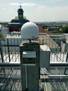
BOKU supports DLR flight trials for satellite based precision approach guidance
Both, the Institute of Surveying, Remote Sensing and Land Information (IVFL) and the Forest Demonstration Centre have supported the installation, and are hosting Global Navigation Satellite System (GNSS) reference stations, one at its main campus (see picture) and one at the Forest Demonstration Centre Rosalia. The data from these stations are used in a network generating corrections for precision approach guidance.
| Dateien |
|---|
| flight.jpg |
| flight2.png |
25.05.2018

