The geohazard assessment is carried out in a four-step procedure:
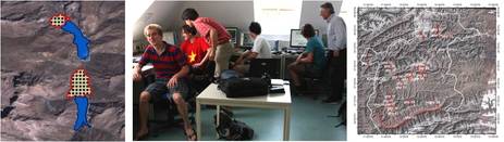
Pre-assessment: GIS and remote sensing techniques were employed for detecting potential source areas and pathways of remote geohazards. The relevant geomorphologic features in the study areas were mapped from medium-resolution datasets (SRTM digital elevation model, LANDSAT and ASTER images) in combination with topographic and geological maps as well as Google Earth. Specific areas of interest were deducted from the mapping results.
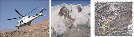
Helicopter survey: the areas of interest identified during the Pre-assessment were viewed from the helicopter. The knowledge gained this way was used to select the areas to be included in the field assessment.
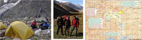
Field assessment: some areas of specific interest were visited in the field by international groups of 4 researchers during summer 2009. In particularly remote areas, they were dropped off from the helicopter. The areas of interest were analyzed and mapped in detail and the level of hazard emanating from the lakes or slopes was estimated.
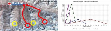
Post-assessment: Based on the field assessment, five areas of particular hazard were selected for further analysis. Scenarios of landslides, dam breaks and flood waves will be built and the possible impact farther down the valley will be assessed using computer models. Based on that, recommendations how to mitigate the hazard will be given to the relevant agencies and stakeholders as well as to the local population.
The results of the assessment are used to design strategies to be integrated in the ongoing risk mitigation program of FOCUS. Such strategies are in particular:
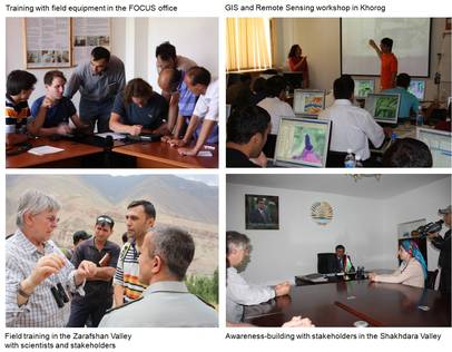
Promoting the awareness and preparedness for geohazards. Target groups are the stakeholders and the people in the villages. The methods include community mapping (for example to identify possible emergency escape ways) and small information workshops.
Initiating the monitoring of hazardous situations (change of lake level, condition of dams or slopes, etc.). This work has to involve both local scientists and the local population. Responsibility shall be handed over to the local population, for example by training the people to do simple monitoring tasks by themselves.
Installing emergency information systems, where necessary. Also here, both the local specialists and the population have to be involved.
Promoting technical measures towards reducing the risk, like deviation dams and retention basins for mudflows, etc.
Training of stakeholders, scientists, and the local population to continue the mentioned mitigation measures after the end of the project
In order to enable the realization of all these activities, much emphasis was put on capacity-building of the local actors: all the relevant agencies, scientists, and stakeholders are involved already in the hazard assessment. The leading Tajik scientists in the relevant fields (meteorology/hydrology, glaciology, geology, seismology) took leading positions during the hazard assessment, working together with the European specialists. A workshop was held for enhancing the knowledge of the local specialists (for example in GIS and Remote Sensing). Two of the Tajik scientists involved stay at IAG-BOKU for three months each in order to receive further training.